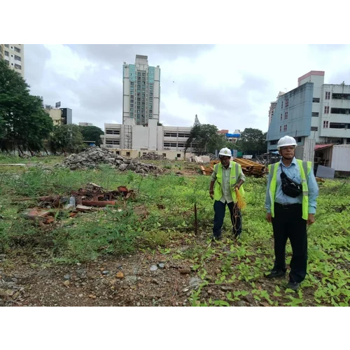
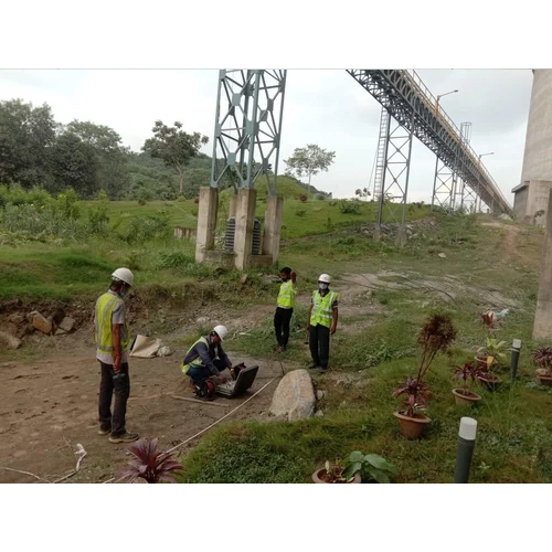
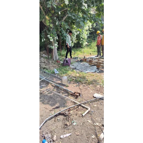
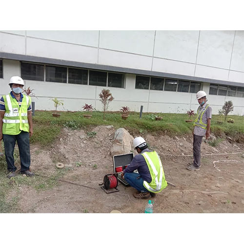
About Groundwater Exploration Survey Services
Capitalise on our Groundwater Exploration Survey Services at a reduced price-an offer that couples meritorious expertise with brilliant precision. Covering up to 500 sq km and detecting depths of up to 300 meters, our preeminent team of expert hydrogeologists utilises cutting-edge resistivity meters, GPS, and borehole logging instruments. With advanced GIS and modelling software, expect high-precision mapping and customizable, detailed reporting within 2-4 weeks. We provide pan-India service and adhere strictly to national water policies while supplying actionable data in multiple digital formats for all groundwater location needs.
Diverse Application Areas & Usage Coverage
Groundwater Exploration Survey Services are utilized across agricultural, industrial, municipal, and residential sectors, ensuring optimal water resource identification and management. The application surface covers up to 500 sq km with a depth capability of 300 meters, using advanced geophysical surveying methods. These surveys are ideal for mapping aquifers, evaluating site suitability for wells, and guiding sustainable water extraction strategies across urban and rural environments.
Export Market, Certification, and Sample Policy
Our Groundwater Exploration Survey Services are competitively priced with a transparent list price and clear quotation system for national and international clients. Packing & dispatch protocols ensure quick and secure transmission of digital reports. We primarily export to markets across Asia and Africa and are recognized for adherence to stringent national water policies. Certified expert hydrogeologists supervise every project, and sample digital outputs are available on request to ensure service clarity before engagement.
FAQ's of Groundwater Exploration Survey Services:
Q: How does the groundwater exploration process work?
A: Our process combines geophysical surveying with advanced GIS and modelling software. Using instruments like resistivity meters and borehole loggers, we collect subsurface data across your chosen site. Expert hydrogeologists analyse this information to map and characterize groundwater resources, delivering actionable results in 2-4 weeks.
Q: What is the main benefit of using your survey services?
A: The primary benefit is the high accuracy in locating potential groundwater resources, which leads to optimal well siting and efficient water extraction. Our reporting includes detailed maps and customized digital reports, enabling confident, data-driven decision making for water resource management.
Q: Where can these services be used?
A: These services are available pan India and are ideal for applications in agriculture, industry, municipal planning, and residential land development-anywhere reliable groundwater identification is needed.
Q: When can I expect to receive the survey results?
A: You will receive comprehensive survey results, including detailed digital maps and reports, within 2-4 weeks of project commencement, ensuring timely project planning and execution.
Q: What type of equipment and software do you use?
A: We use advanced resistivity meters, GPS, and borehole logging instruments in the field, while data analysis is conducted via up-to-date GIS and hydrological modelling software.
Q: How is the data delivered and in which format?
A: All data is delivered in digital formats, including detailed maps and customizable reports, tailored to your requirements for easy integration into your project documentation and planning.


 Send Inquiry